

2020 - 2022
Schiehaven
2020 - 2022
Schiehaven
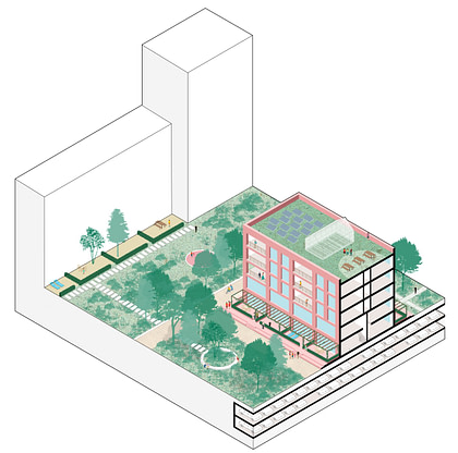
Within the range of (post-)industrial Rotterdam harbours, the Schiehaven is unique because of its large contact area with both the Maas and the Westzeedijk. These urban landscape structures, which are important to Rotterdam, give their own identity to the planning area. A new green quay with plenty of functions offers opportunities to experience the Maas from nearby and connects the Delfshaven neighbourhood directly with the Maas.
Location
Rotterdam
Client
Gemeente Rotterdam
Collaboration
SHIFT Architecture Urbanism
Surface Area
12 ha


A new city square in front of the Maaskant building will have broad, robust steps along the river: The Maastribune. Meadows on the quay combined with new and existing sports and games facilities enrich the neighbourhood. Natural zones and indigenous planting are located both on and along the quay and enhance biodiversity. The experience of the Westzeedijk as a long, scenic city structure is centred on the north side of the plan and is activated with entrances on the side of the dike. The urban and at the same time very green plan provides for a varied mix of no less than 1000 homes. The existing heritage – including the Maaskant building and the Marshall warehouse with cultural and social functions – will be given a prominent place in the plan. The new buildings have their footprints in the green and form sheltered inner courtyards.


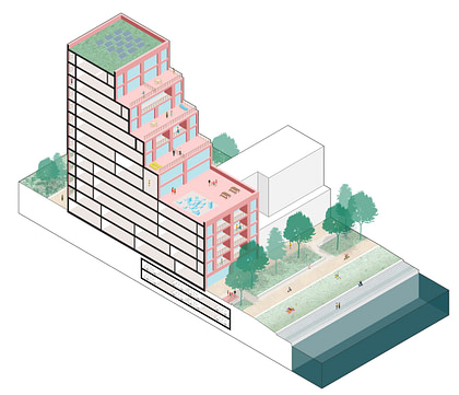
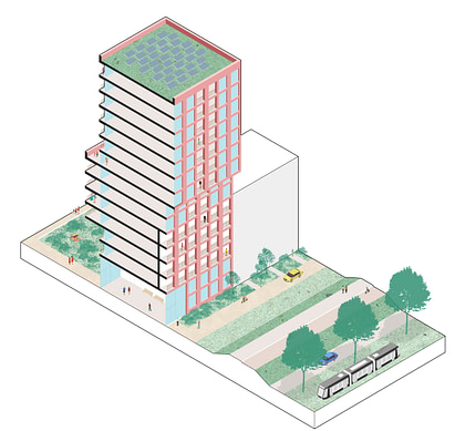

The plan has a layered structure, which has its own definition at the level of the city, the neighbourhood and the building. At the city level, the plan manifests itself as two urban superblocks. At the scale of the neighbourhood, the plan reads like a sequence of connected building blocks. On the scale of the building, there is a deliberate focus on a small grain of 1, 2 or 3 volumes. Each layer of the plan connects to the city and the public space at a different level. The superblock connects to the urban axes of the Westzeedijk and the Maaskade, as well as the linear inner area. The sequence of courtyards forms local, collective living spaces for the neighbourhood community. The individual buildings contain private and shared outdoor spaces, in the form of gardens, loggias, balconies or terraces.


