
2023 - ongoing
Lange Weeren, Volendam
2023 - ongoing
Lange Weeren, Volendam
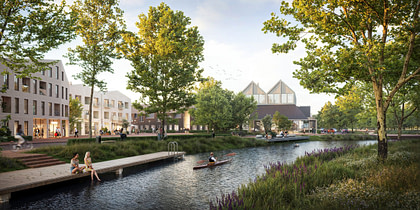
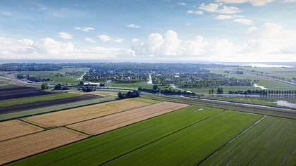
Situated between village and landscape, ‘De Lange Weeren’ will add a new form of landscape living to the town of Volendam. The plan combines several major challenges for Volendam. Together with various housing projects in the urban area, De Lange Weeren provides the necessary housing for the municipality and region. De Lange Weeren is also the most important water buffer location in Volendam. Excess rainwater is collected in the area to prevent flooding in the rest of the village. As the final extension of the village, De Lange Weeren will also become the new village edge of Volendam. With the new village silhouette and the gradual transition between village and landscape, De Lange Weeren will offer the first impression of the municipality to visitors of the region. The optimal integration of housing, waterbuffer, nature and landscape lead to a special new living environment.
Volendam
Gemeente Edam-Volendam
René Kuiken Urbanism,
Nelen & Schuurmans, HHNK, Goudappel Coffeng and land owners
Vivid Vision (renders)
83 ha
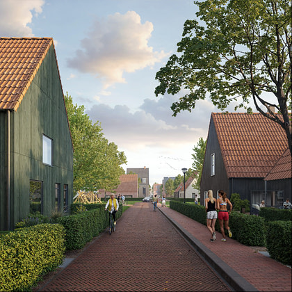
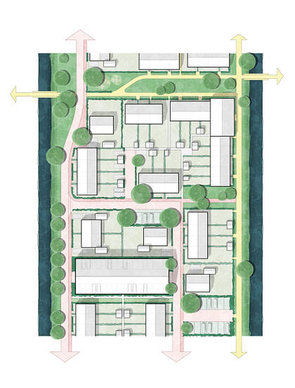
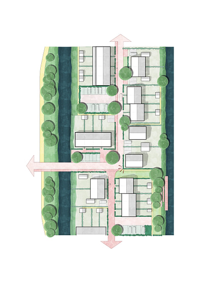
De Lange Weeren (1160 dwellings) is strongly based on the underlying landscape. The characteristics of the long and narrow parcellation of the peat landscape and the existing watersystem form the basis of the lay-out of the new neighborhood and give de Lange Weeren a unique character, fitted in the surrounding landscape. The development of de Lange Weeren is based on the criteria of the ‘Pilot Waterland’ in which housing development in the vulnerable landscape of Waterland is being regulated by concentrating new developments and keeping the open landscape free. This includes an additional investment in a fund intended for nature, landscape and recreational purposes.

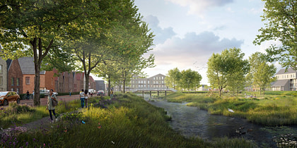
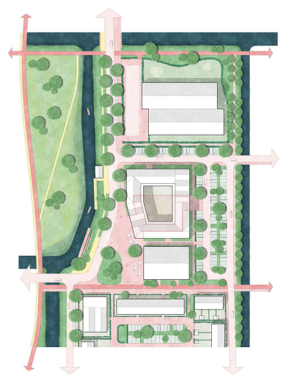
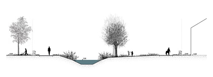
By following the underlaying landscape in the lay-out of the plan, the various neighborhoods are anchored in a landscape of ditches, reed fields and meadows. The edge of the district presents itself as the new village edge of Volendam. A differentiated edge sometimes shows a new striking village silhouette and is then again hidden behind rows of willow and alder trees. A green-blue framework runs through the district with richly planted waterways and meadows. Each neighborhood has direct access to this fine-meshed green structure connecting every neighborhood to the surrounding landscape. The village meadow is centrally located in the plan. This elongated park is a continuation of the surrounding landscape and allows the landscape to penetrate deeply into the heart of the neighborhood both physically as well as visually. Along the village meadow, the main street and the village center with various facilities form the heart of Lange Weeren.


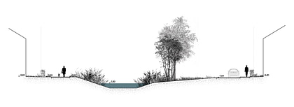
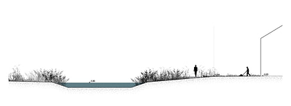
Within the Volendam water system, the Lange Weeren polder acts as the most important water storage location. Excess rainwater is collected in the area to prevent flooding in the densely populated and low-lying neighborhoods of Volendam. To maintain and even increase the buffer capacity of the polder while building a new residential area, water storage and neighborhood are optimally interwoven. Based on the principles of water and soil-based planning (bodem en water sturend), we chose to raise De Lange Weeren development only to a limited extent. This means that the existing plot structure, ecology and watersystem can be preserved as much as possible, and less sand is needed for raising the buildingsplots. Ultimately, integrating water storage in the neighborhood leads to more water storage capacity compared to a segregated solution. The Neighborhood will be built based on a stepped profile where the current ground level will be retained in the public green areas. The public streets will be slightly higher in order to achieve the necessary drainage followed by gardens and buildings. In this way, the waterways and public greenery in the neighborhood are provided with storage capacity while the streets and plots remain dry and accessible.

De Lange Weeren shapes the transition between village and landscape. Here the current peat meadow landscape transforms into a diverse landscape park with alternating flowering grasslands, reed beds and open water. The ground level is being lowered on various plots. This creates a diverse image with various natural biotopes as well as additional capacity for water storage. The landscape park will be accessible for recreational purposes through a network of paths. Since the district and the flank have the same water level, exploring the landscape park by boat or canoe adds to the recreational value of the park.


